TIÅMÅT / CLIMATE & NATURAL HISTORY
The Great Thaw &
the Northern Crossing
Glaciers gave way to rivers and wetlands. Long after the first meltwater valleys opened, five shallow seas retreated and an ancient northern strait became a road between continents.
Where the ice retreated
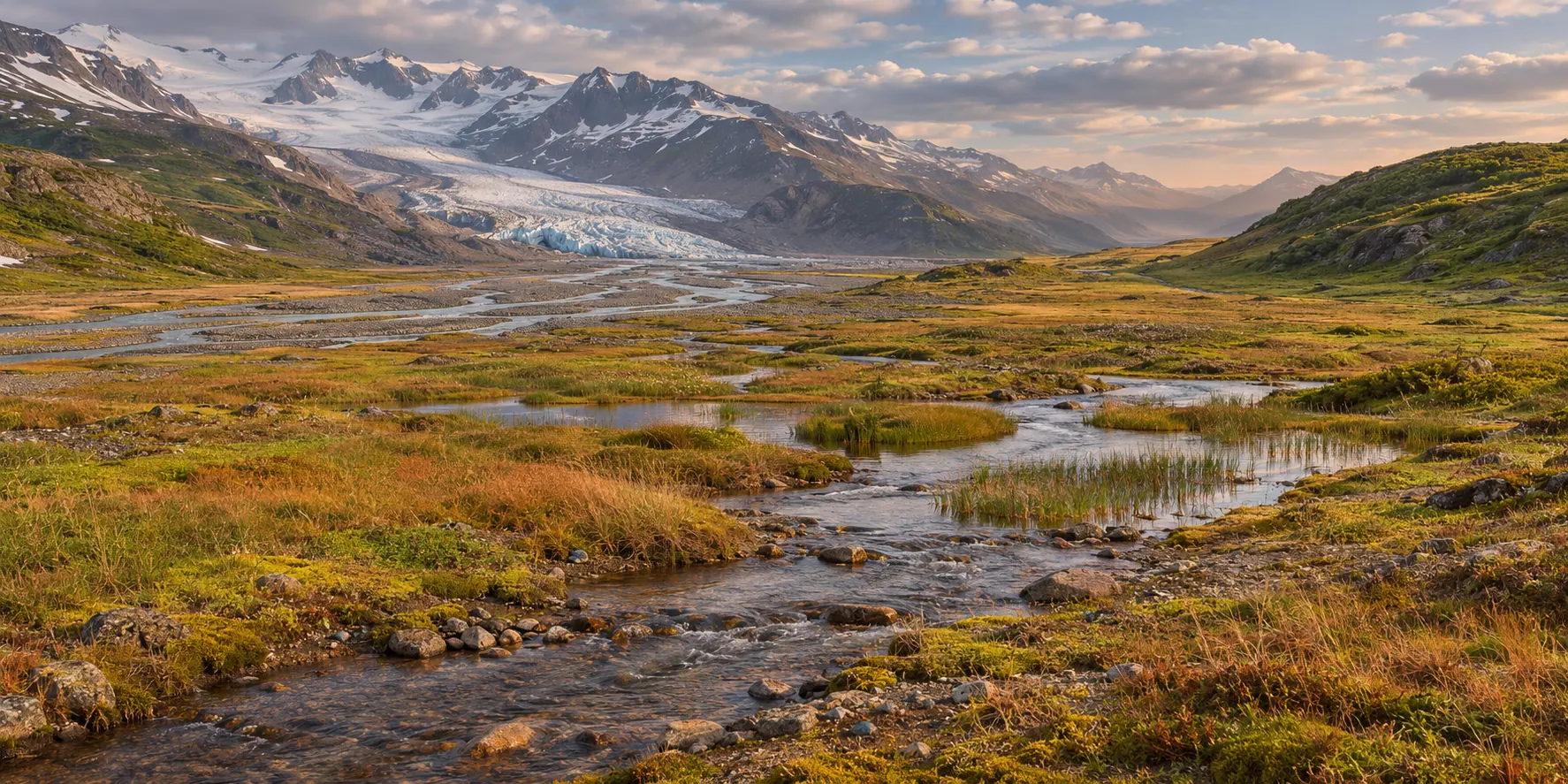
The transfer into the binary system changed the light reaching ice that Tiåmåt already carried. Valleys opened as the ice retreated. Glacial lakes fed rivers and wetlands, and gaps between habitable valleys narrowed. Some ice remained in the far north and high mountains. The extent and timing of the thaw varied with the season, latitude and local terrain.
As Takbiru expanded and its surface cooled, its light shifted toward longer wavelengths. Different surfaces absorbed that light differently. The heat absorbed by exposed water, bare ground and ice depended on the spectrum as well as clouds and the amount of energy reaching the planet. See Takbiru’s evolution and the climate and energy balance.
What kept a refuge alive
Where a spring or a river stayed fresh through the lean season, plants and prey could persist. Populations also needed enough usable ground and a way to reach other sheltered valleys as conditions changed. On the coasts, well-flushed shallows supported marine food webs while isolated pools grew saltier. Rock shelters reduced exposure, but people and animals depended on air exchange and on food grown or gathered beyond the shelter.
The long seasons posed a different limit in the glacial north. People and large animals could use northern ground when light and forage allowed. Through prolonged darkness, they depended on links to areas with continuing food production. The thaw widened some of those links, helping populations survive and spread on their own continents before the Northern Crossing opened.
- Water through the dry seasonSprings, groundwater and flowing streams sustain drinking water and oxygenated habitat.
- Food through the lean seasonSunlit wetlands, freshwater margins and sheltered slopes support growing plants and the animals that feed on them.
- Routes between refugesConnected valleys and coasts let populations move, reproduce and return as ice and water shift.
Explore how these pressures shape the biosphere, the wildlife of Tiåmåt and how life evolved.
How the strait became Vel-Karak
The two continents faced one another across a shallow northern threshold. Meltwater could raise the ocean while the rock beneath the strait, relieved of part of its ice load, rose over generations. Once the threshold rose faster than the water, the shoreline receded relative to the land. Surviving channels and pools occupied the lower ground. At first the highest parts of the sill emerged during favorable tides. In time its crest formed a continuous overland route. A deeper tidal reach survives at the crossing. Small boats use it between the two landings when depth and current allow.
- Submerged threshold The ocean covers the sill and water moves through the strait.
- Shallow tidal passage The ocean has risen, but the rock has risen farther. High points emerge at favorable tides.
- Continuous land route The crest emerges above high water while deeper basins and side channels remain.
Where the five seas retreated
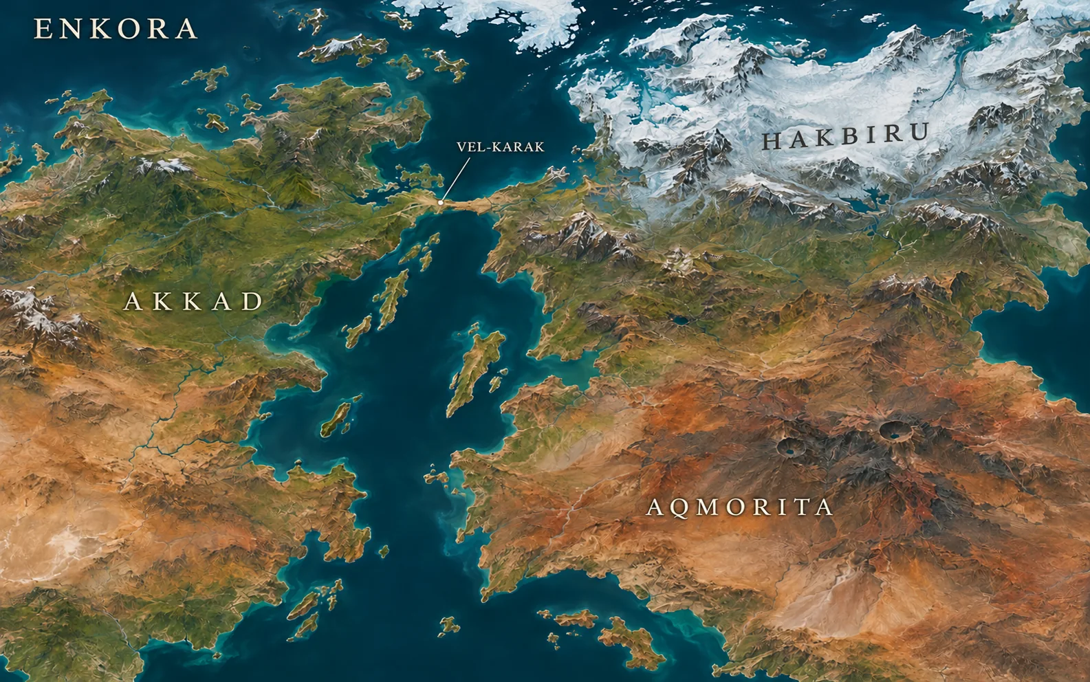
- Kur-Nak · Former northern strait at Vel-Karak.
- Kharet shelf sea · Shallow shelf on the Akkad side, northwest of the crossing.
- Tharen outer embayment · A former approach to Dul-Maresh beside Kur-Ashek.
- Kishar foreland bay · A cold bay along the Hakbiru-side foothills of Kishar.
- Fire Belt coastal basin · An embayment of the volcanic south, separate from Kur-Velakh.
Different shallow basins lost exchange with the ocean in succession. Where evaporation then exceeded rain and inflow, the water lowered and concentrated its salts. Broad navigable expanses gave way to flats, isolated brine pools and smaller bodies of water. Seas with sufficient inflow or continued connection persisted, including Kur-Ashek and Kur-Velakh. The northern ocean remained.
The raised northern route later carried the garrison and railway at Vel-Karak. Its emergence changed the histories of both continents. The rails and foot routes follow high ground above the surviving tidal waters. See the geology of the retreating seas and the tides of the four moons.