Planet
Tiåmåt
Circumbinary Takbiru–Takmat system; the physical setting of continents, seas, ice and inhabited regions.
Continents & crossingsTIÅMÅT / PLACES & ROUTES
Mountains, retreating seas and hidden water shape the routes of Enkora. Its political borders overlap a landscape whose physical connections keep changing.
At Vel-Karak, the North Bridge links the Akkad continent to the continent shared by the Hakbiru and Aqmorita. The land corridor follows the raised sill of Kur-Nak, the former northern strait. Deeper remnant waters flank the crossing. A sheltered reach of the old tidal channel still connects paired Akkad and Hakbiru landings for small craft, while the railway and road follow the raised ground. Read the history of the Crossing ↗
Enkora names the connected civilizational and geopolitical sphere. It is not a synonym for one continent, the Akkad people or the whole planet.
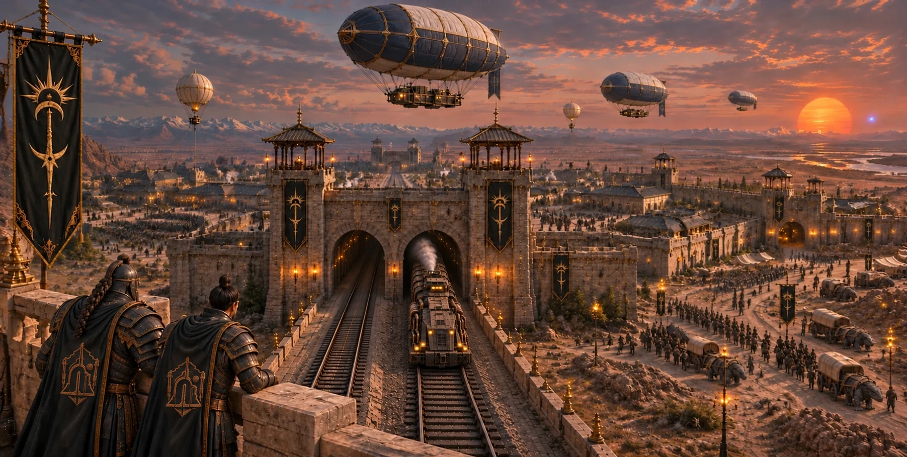
Vel-Karak, fortress of the North Bridge. The name begins with Vel’, a word for fortress. House Karak watches over the crossing from this stronghold. An Akkad steam train emerges from one of the two rail tunnels through the fort, while troops and supply carts use a separate gate and road.
Search by name or landscape. The entries describe relationships rather than assigning coordinates or distances.
35 places
Planet
Circumbinary Takbiru–Takmat system; the physical setting of continents, seas, ice and inhabited regions.
Continents & crossingsContinent
Homeland of Akkad civilization and its principal urban, political and industrial networks.
Continents & crossingsContinent
Northern Hakbiru ice lands and volcanic Aqmorita regions; includes glacial reserves and the Fire Belt.
Continents & crossingsCivilizational sphere
The connected territorial and geopolitical sphere of the known powers, not one continent.
Continents & crossingsLand crossing
A land corridor across the raised sill of Kur-Nak. It links two continents by road and rail between remnant waters.
Continents & crossingsOcean
The northern Ocean of Silence, associated with ice and glacial inputs.
Water & coastsResidual sea
The Dying Sea retreats from Tharen, leaving salt flats, stranded ports and remnant channels.
Water & coastsGeothermal sea
The Sea of Ash in the volcanic south, linked to mineral springs and adapted navigation.
Water & coastsGlacial source
A source in the Kishar Mountains and Hakbiru territory, used in measuring the ice system.
Water & coastsRiver threshold
The meeting of Hakbiru watercourses with the Akkad distribution network.
Water & coastsRiver
Three cultural names for the same great watercourse downstream of Gaumukh.
Water & coastsMountain range
The transition into the glacial north: an ice reserve, climatic barrier and network of passes.
Glacial northSubglacial city
A northern Hakbiru settlement and center of memory beneath the ice.
Glacial northMassif & fortress
An elevated ice stronghold within the Hakbiru Kishar territory.
Glacial northMonastery & refuge
An isolated northern monastery and center of study.
Glacial northCapital
Political and institutional center of Kharet and a convergence of routes.
Cities & institutionsMonumental district
The central ensemble of Esh’Kharet’s major political, scientific and religious institutions.
Cities & institutionsUrban bastion
A religious, archival and observational landmark in Esh’Kharet.
Cities & institutionsHistoric seat
House Akdar’s original seat in Akkad lands; distinct from the industrial extension Ish’Erikdu.
Cities & institutionsFortress
The defensive and ceremonial core within Erikdu.
Cities & institutionsCapital
Formal and abbreviated names of the same principal center in Nivek / the Wastelands.
Cities & institutionsPolitical center
Center of the dry interior Domain of Ashkur and its water connections.
Cities & institutionsPolitical center
The seat of Gorath, distinct from its commercial node Ven-Gorath.
Cities & institutionsCommercial node
Gorath’s main market connection to interior routes.
Cities & institutionsPolitical center
Tharen’s former coastal center, associated with stranded ports and saline plains.
Cities & institutionsUnderground city
A southern industrial settlement linked to House Kadbal.
Cities & institutionsTerritorial reference
A political and territorial reference within the southern Domain of Surian.
Cities & institutionsMining ridge
The Kharet–Tarek frontier: veins, faults and contested approaches to the mining network.
Volcanic landsVolcanic caldera system
East of Zarakh along the Khur-Tarek Ridge. Known in Aqmorita tradition as Qur’Daq, Dazhuk contains Tarek’s principal Tear-extraction complex.
Explore Dazhuk ↗Volcanic landsPrincipal extraction complex
Tarek’s principal Tear works within the caldera of Dazhuk / Qur’Daq. House Malurk controls the complex, access routes, processing infrastructure and surrounding deposits under Ak-Malurk the Gray.
Explore the Maw ↗Volcanic landsVolcano
The active southern volcano: Zarakh in Akkad usage, Qur’Gal in Aqmorita usage.
Volcanic landsMining complex
Vaults, galleries and extraction levels within the caldera of Zarakh / Qur’Gal.
Volcanic landsMining installation
The Maw’s operating center, where command, security and regulation converge.
Volcanic landsIndustrial extension
Processing, transport and custody near the Maw; linked to Erikdu but not its historic seat.
Volcanic landsLogistics route
The route between the Maw, Ish’Erikdu and the industrial network.
Volcanic landsNo places match this search.
Shoreline records place these losses in the following order. Each basin lost its continuous stretch of open water, though brine pools, tidal channels and smaller waters could persist.
Glacial sources and northern passes connect Hakbiru water with interior distribution networks.
Dul-Maresh → Ven-Gorath → Esh’Kharet. Retreating coasts connect with markets and the political center.
The Maw → Ish’Erikdu → processing and custody networks. Mineral, supplies and personnel follow this route.
Mountain passes give access to the north. Southern paths link settlements and aquifers around lava, gases and unstable rock.
Kur-Ashek’s retreat leaves old ports, mineral terraces, salt crusts and residual channels. Ground that appears dry can conceal brine and unstable sediment. Dul-Maresh carries the consequences of that changing coast.
The Kishar Mountains concentrate ice and passes. Underground water sustains refuges where the exposed surface is hostile. A source’s existence does not guarantee its accessibility, quality or political availability.
REAL-WORLD CONNECTIONS
These sources explain the real physical or social principles discussed here. Tiåmåt’s peoples, places and institutions belong to the fictional world.